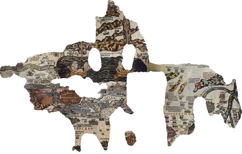
The Madaba Mosaic Map is a unique piece of art created in the 6th century C.E. as a decoration for the pavement of a church in the town of Madaba (in today's Jordan). The mosaic represents the biblical land from Egypt to Lebanon, including Sinai, Israel, Palestine, and Transjordan. Unfortunately parts of the map were damaged during the 19th century but what remains is still of the greatest importance for art, history and biblical topography.
The city of Jerusalem is depicted with the utmost care, with more than 150 places or biblical memoirs that are presented in the preserved portion of the map. Most of the labels are concerned with biblical locales, regional names, and events. The map marks Jericho with palm trees, 12 stones at Gilgal, Jacob's well in Shechem, the Oak of Mamre at Hebron, John's baptism of Jesus in the Jordan River and Bethlehem. The largest and most detailed topographic element on the map is Jerusalem. The mosaic clearly shows a number of significant structures in the city: Damascus Gate, the Church of the Holy Sepulcher, the Tower of David and the main Cardo street.