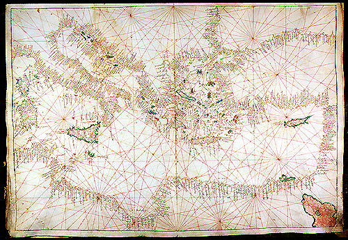
Battista Agnese, Venice, ca. 1535-1538
Portolan atlases were sea charts that used a network of "thumb" lines centered on a compass rose to represent distances between points--literally, "port to port." The earliest extant portolans date from around 1300, but it is likely that they incorporate much older traditions, possibly stretching back as far as classical antiquity. Portolans were originally utilitarian documents of great value to sailors. They facilitated the navigation and exploration of the Mediterranean and, by the fifteenth century, of the wider world as well. Between 1300 and 1600 thousands of these atlases were produced, chiefly in Spain and in Italy. However, by the sixteenth century portolans became collectors' items. Artful cartographers sought to take advantage of this new market by producing luxury atlases like the one on display for the wealthy. Battista Agnese, who was active between 1527 and 1564, was one of the most accomplished and successful maker of luxury portolans. More than seventy of his atlases survive, of which this is a particularly early example.
The distinguished provenance of the atlas reflects the value of the genre in the sixteenth century. It was presented to the eminent scholar Paolo Giovio in 1541 by Tommaso Compeggio, Bishop of Feltre and papal diplomat.
Parchment, 7 double-page maps, 398 x 285 mm.