Visualizing Space with Leaflet

Main content

Visualizing Space with Leaflet
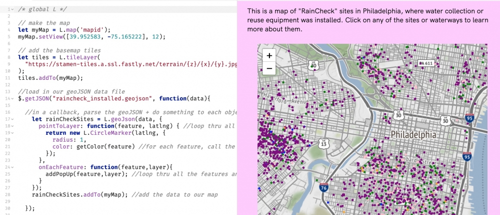
Leaflet.js is a lightweight, open source Javascript library that is widely used to create and share web mapping projects online. It is a great tool for creating an interactive map that can be embedded in a larger digital project. This workshop introduced the basics of setting up a Leaflet project and displaying a simple map with some data, using only a few lines of code. Because this involves a tiny bit of Javascript, Leaflet.js is suitable for folks who have some programming experience or are feeling adventurous about learning to code.
 
 
To view the recorded workshop and the full walkthrough of the exercise, visit here.

About the Author

Cassandra Hadril
Cassandra Hradil
Digital Humanities Specialist
Cassandra serves as a liaison between the Libraries’ Center for Research Data & Digital and the Price Lab. She specializes in managing and supporting digital projects across a range of media. Her interests include archival information systems, decolonial mapping, queer interfaces, e-textiles, and feminist data visualization.

Cassandra serves as a liaison between the Center for Research Data & Digital Scholarship in the library and the Price Lab for Digital Humanities. She specializes in managing and supporting digital projects across a wide range of media.

In her own practice, Cassandra is an artist, designer, programmer, and scholar who balances the critical with the creative. Her research and design interests include archival information systems, decolonial mapping, queer interfaces, e-textiles, and feminist data visualization. She is a designer and developer at the Immersive Realities Lab for the Humanities, and she teaches part-time at Parsons School of Design.

She has a bachelor’s degree in American Studies and Classics from Amherst College, where she also received the Five College Certificate in Native American and Indigenous Studies. She holds an MFA in Design and Technology from Parsons School of Design.