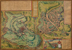
Between 1572 and 1617, Georg Braun, editor, and Franz Hogenberg, engraver, produced the Civitates Orbis Terrarum, a multi-volume collection of views of cities of the world published to complement the first modern atlas, Abraham Ortelius' Theatrum Orbis Terrarum, a map collection first published in 1570. Collector Jack Sosiak's large group of Braun and Hogenberg's city views are exhibited, together with related city views from Penn's own collections. This exhibition is presented in conjunction with a gathering of contributors to the Oxford Handbook on Cities in History.
A checklist to the exhibition may be downloaded here.
Tuesday, March 15, 5:30 PM: Exhibition Opening
Friday, May 13, 4:30 PM: What Good is an Old Map in the Age of Mapquest?
Join Dr. Daniel Traister, Curator for Research Services at Penn's Rare Book and Manuscript Library, and map collector Jack Sosiak to explore what 16th- and 17th-century maps of European cities offer that Mapquest cannot. Thirty minute lecture, followed by reception and viewing of current exhibition, Renaissance City Views from Above and Afar.